Situated between the Pacific Ocean and lush rainforests lies the Central Pacific region of Costa Rica. Known for its incredible biodiversity and abundance of national parks and protected areas, this part of Costa Rica is a true nature lover’s paradise.

The central Pacific weather zone extends south from the Tarcoles River to the Baru River, north of Dominical, in the western parts of the San Jose and Puntarenas provinces. Puntarenas town, Jaco, Quepos, Manuel Antonio, and Parrita are also included in this region.
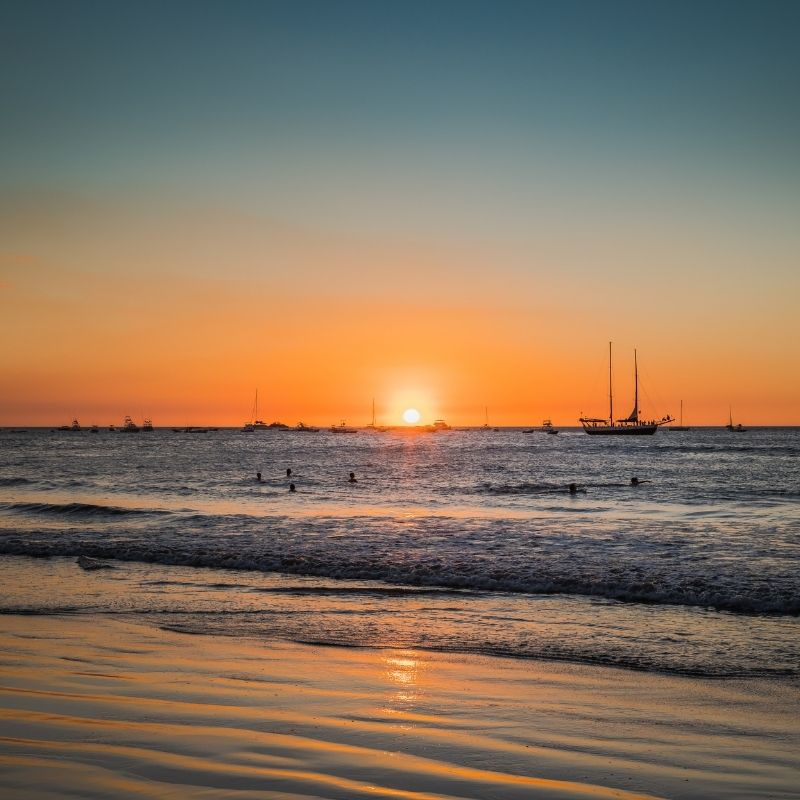
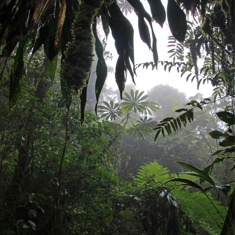
The region encompasses miles of pristine coastline dotted with world-class surf breaks, secluded beaches, and charming beach towns. Just inland lie some of Costa Rica’s most renowned national parks like Manuel Antonio and Carara, home to monkeys, sloths, toucans and hundreds of other exotic species.
Route from San Jose to the Central Pacific Region of Costa Rica:
The drive from San Jose airport to Manuel Antonio on Costa Rica’s central Pacific coast takes around 3 hours depending on traffic.
Upon leaving the airport area, follow signs getting on Route 27 west towards the beach community of Jaco. This is a scenic highway that connects San José with the Pacific coast and has several toll plazas along the way.
The first toll you’ll encounter is in Escazú, cost varying by vehicle type and distance. The next toll is in Santa Ana, also priced based on vehicle and distance. Further along is the toll in Ciudad Colón before reaching Orotina. The final toll on Route 27 is at Atenas. Four tolls in total.
Route 27 passes through coffee plantations and small towns in the Central Valley before descending through lush green mountains towards the coast.
In Jaco, turn south onto Route 34 which winds along the coastline through palm forests and over mountain-fed rivers. Stop to enjoy ocean vistas before continuing to Quepos, the gateway to Manuel Antonio National Park. Follow signs leading into the park and beach area just 15 minutes further south.
The final leg passes white sand beaches, jungle-clad cliffs, and possibly wildlife like monkeys before arriving in Manuel Antonio. With postcard views and abundant activities, it’s easy to see the appeal of this destination. The well-marked roads make for straightforward driving, but have colones ready for the tolls along the way.
Distances from the International Airports to the Central Pacific Region of Costa Rica:
From San Jose:
Carara National Park: Approximately 43 miles (70 kilometers), 1.5 hours by car
Jaco Beach: Approximately 59 miles (95 kilometers), 2 hours by car
Quepos: Approximately 99 miles (160 kilometers), 2.5-3 hours by car
Manuel Antonio National Park: Approximately 106 miles (170 kilometers), 3-3.5 hours by car
Baru River: Approximately 112 miles (180 kilometers), 3.5-4 hours by car
Dominical: Approximately 118 miles (190 kilometers), 4-4.5 hours by car
From Guanacaste International Airport:
Carara National Park: Approximately 124 miles (200 kilometers), 3.5-4 hours by car
Jaco Beach: Approximately 140 miles (225 kilometers), 4-4.5 hours by car
Quepos: Approximately 180 miles (290 kilometers), 5-6 hours by car
Manuel Antonio National Park: Approximately 186 miles (300 kilometers), 5.5-6.5 hours by car
Baru River: Approximately 193 miles (310 kilometers), 6-7 hours by car
Dominical: Approximately 199 miles (320 kilometers), 6.5-7.5 hours by car
Please note that these are estimated times and may vary depending on traffic, road conditions, and other factors.
The Weather in the Central Pacific Region of Costa Rica
This weather zone has less climate continuity than other sections of the country due to its location and inclusion of coastal areas and mountains (up to 1870 masl. – 6,167 feet above sea level). The average rainfall at the coast is 143 inches per year (2434 mm), but as you get into the mountains up to 2,500 feet above sea level (762 masl), the rainfall nearly doubles to 262 inches per year (4293 ml).
The dry season lasts from January to March in this region, with February being the driest month. The rest of the year is technically wet, with October being the wettest. During the rainy season, there are usually five hours of sunlight and eight hours of sunlight from January to April. The days begin sunny, with clouds moving in early afternoon and rain falling later in the afternoon and/or at night.
The average temperature on the shore is 81 degrees, while in the highlands it is 63 degrees. Between January and May, average daytime temperatures along the coast reach 90 degrees, and temperatures never fall below 71 degrees at night. Temperatures in the mountains can dip below 48 degrees.
The relative humidity is always about 85%. It reduces to between 75 and 80 percent humidity in January and February, and reaches 90 percent humidity in June, September, and November. The days are dominated by winds from the south, while the evenings are normally calm with mild breezes from the east.
In our next article we will be talking about the different towns, beaches and attractions of our region, the Central Pacific Region of Costa Rica.